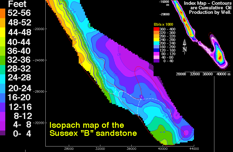
 An isopach map displays the stratigraphic thickness of a rock unit and is generally used in geological exploration for oil and for underground structural analysis. This particular isopach map created by the US Geological Survey is part of a reservoir characterization of the House Creek Oil Field, Powder River Basin in Wyoming. It is showing the thickness (in feet) of Sussex "B" sandstone. If I understand the illustration correctly, by looking at the small inset map of oil production, the higher producing wells are located where the sandstone is thicker.
 Link to website source:
http://pubs.usgs.gov/dds/dds-033/USGS_3D/ssx_txt/all.htm
No comments:
Post a Comment